1 / 8
Coyote Gulch
Southern Utah, USA
Map
Directions
Save
Trail GPX file
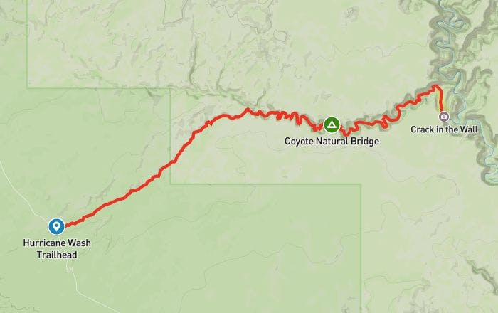
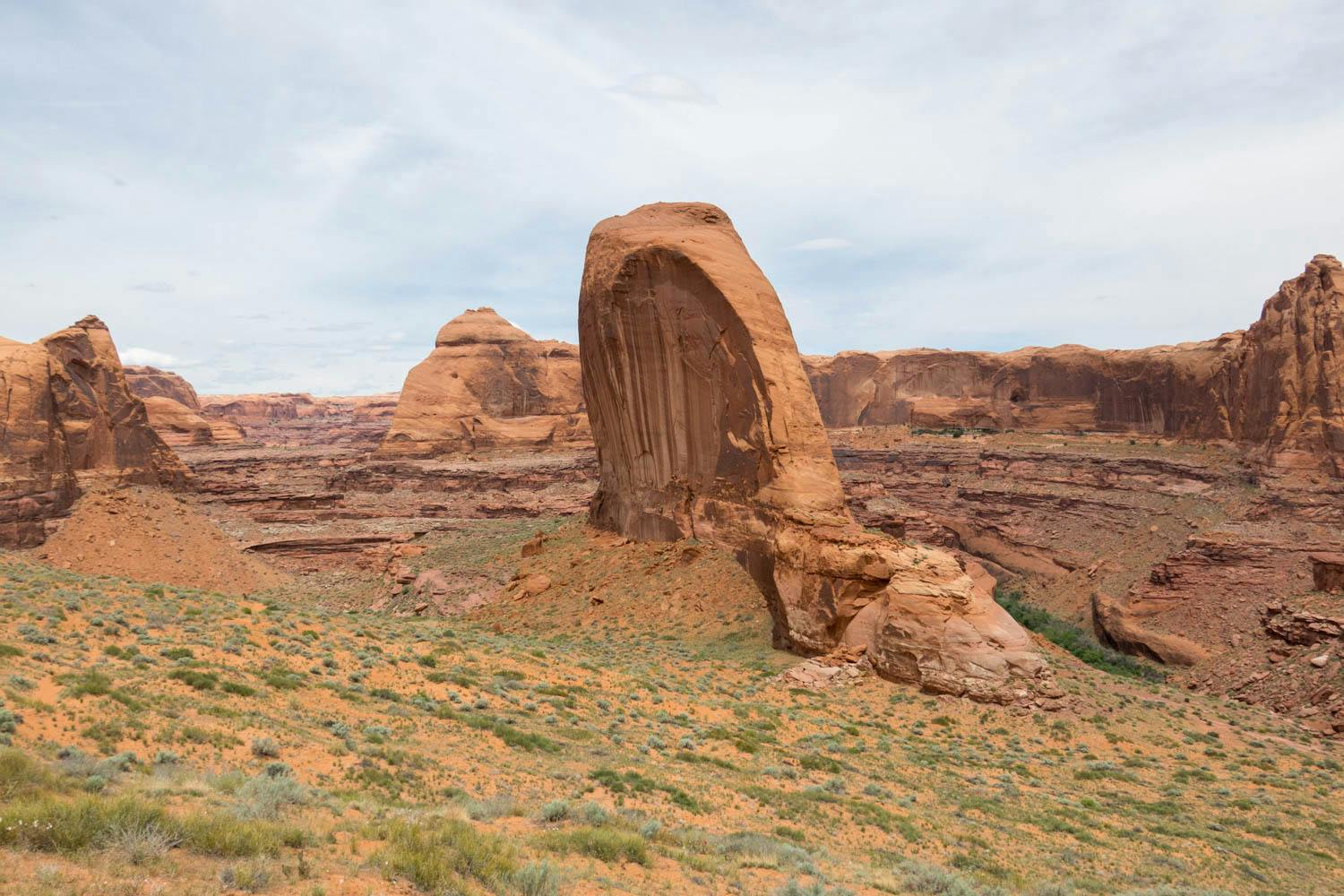
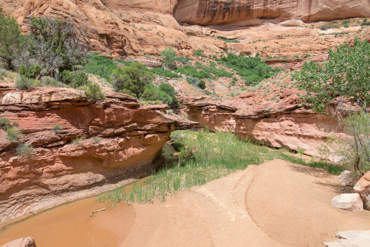
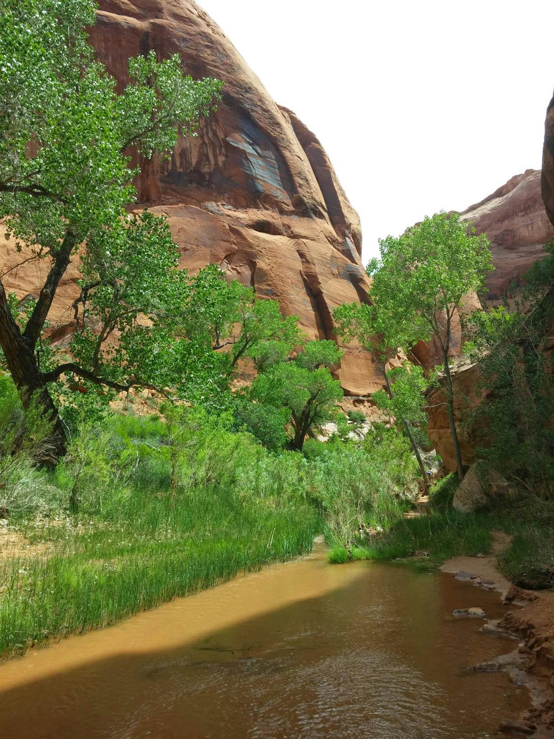
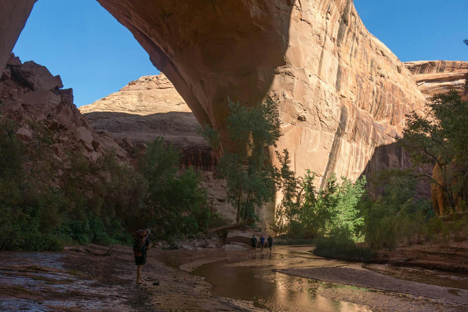
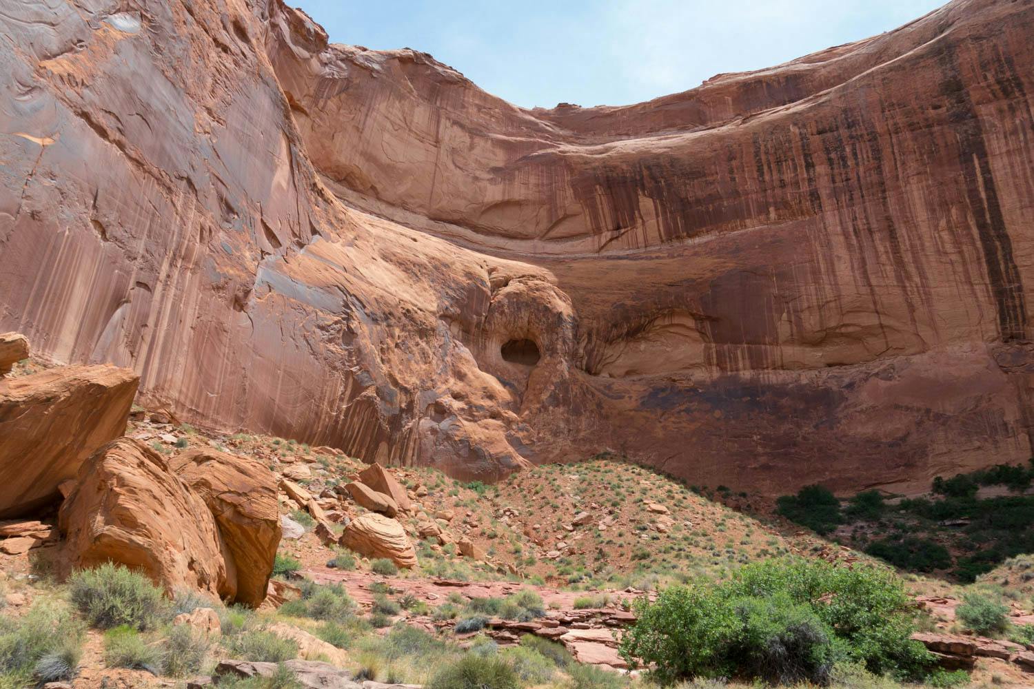
From Hurricane Wash, Coyote Gulch gradually opens up into an incredible desert oasis. The seemingly hidden location feels like a secret paradise only reached by those willing to venture far enough. And while the trail itself is popular, the serene beauty, meandering garden streams and epic desert vistas make any journey here more than worth it.
There are multiple ways to experience the Coyote Gulch area. These include point to point trips with 2 vehicles, a round trip route via the Fortymile Ridge Trailhead, or simply hiking a section of the trail as a day hike. The route detailed below allows you to see as much of the beautiful desert landscape as possible. However, any path you choose to experience Coyote Gulch will not disappoint.
Length
27 mi
Elevation Gain
4,593 ft
Best Time to Hike
Mar - May & Oct - Mid Nov
Duration
3 days
Difficulty
Moderate
Trail Type
Out & Back
When To Go
The spring months of March to May and autumn months from October to mid November are the most recommended times to visit. These months will receive cooler daytime temperatures and there will be less chance of flash floods.
How To Get There
Once in the town of Escalante, drive roughly 5 mi southeast on Highway 12 until you reach Hole in the Rock Road. The closest airport to Escalante is Salt Lake City International Airport (5.5 hrs by car). On Google Maps, the road is also called BLM 200. Hole in the Rock Road is not paved and can be extremely bumpy and slow to drive on, especially without an off-road vehicle. In fact, if you get unlucky with the weather and the road is wet, you will most likely need an off-road vehicle or seriously risk getting stuck.
If the weather is suitable and you are able to drive on the road, be patient and don’t drive faster than you need to. One missed soft shoulder could damage your car or injure you.
After around 32.9 mi on the dirt road, you will see a turnout for a livestock corral. Right after this, there will be another turnout. Take this turnout and then proceed to the trailhead where you will park your vehicle.
Permit
Obtain permits at the Escalante Interagency Visitor Center in the town of Escalante or at one of the entry trailheads. Day use does not require a backcountry permit, but please sign the trail register. Check out the official trail website for more info.
Where To Camp
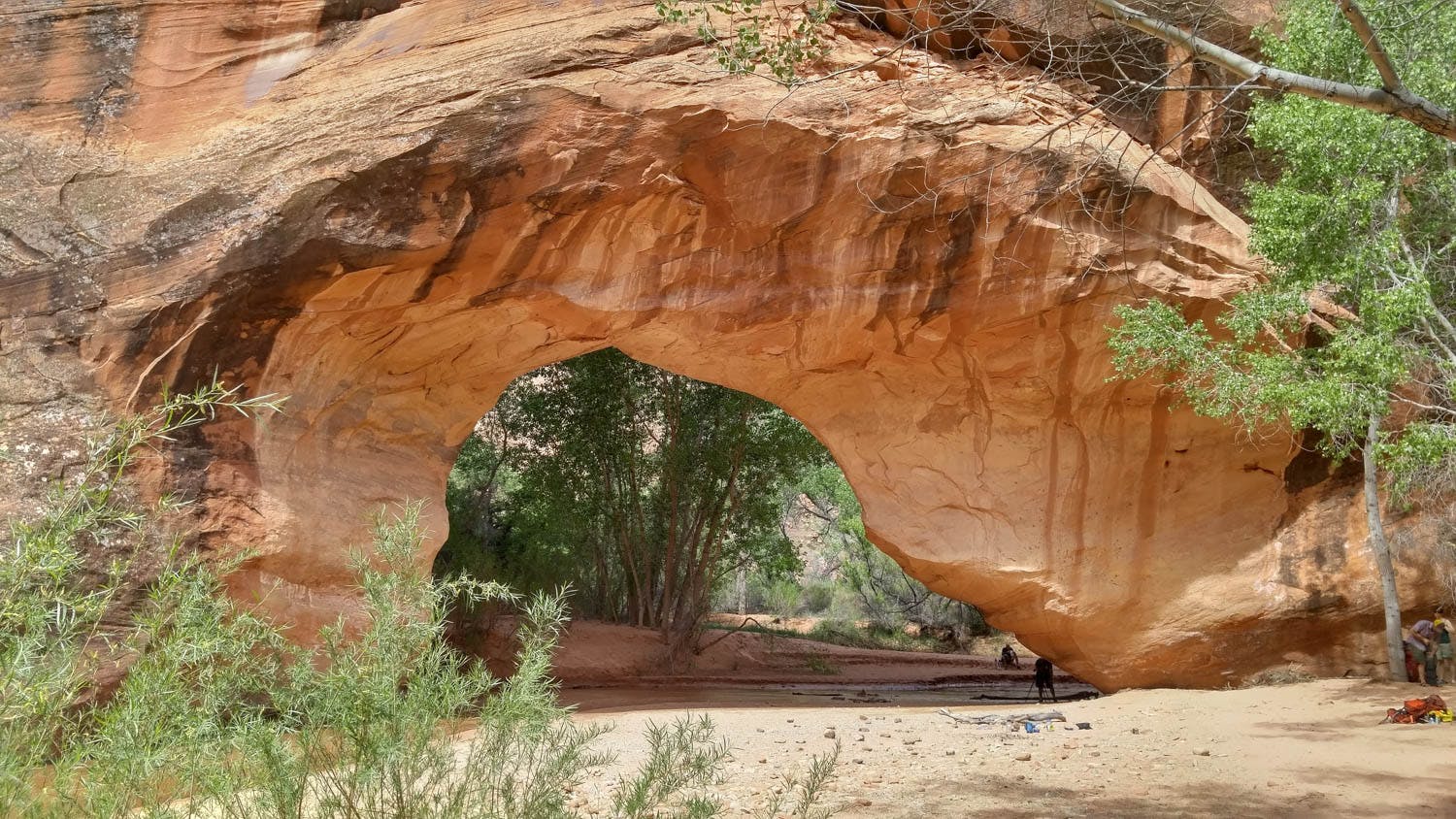
There are technically no official campsites, however it is strongly advised to camp at sites previously used and around specific areas of the trail (such as Jacob Hamblin Arch and near Steven’s arch). The popularity of the trail has increased greatly in recent years and the ecosystem will be stretched to its limit if human activity and waste is felt throughout the trail. It also spoils the trail itself.
Know Before You Go
Clothing - Similar to other destinations in the desert, days are hot and nights can be cold. Even in the height of the summer, you’ll want to have a layers for cold night time temperatures and hot midday heat.
Shoes - Once you are down in the canyon, you’ll be spending almost all your time going in and out of shallow, sandy water. One option is to hike in highly durable, waterproof shoes. However, these can be heavy and if they do end up getting wet, they may be wet for a long time. In the dry desert heat, a light porous hiking boot or trail running shoe may be better suited since you won’t need to worry about water leaking in. Or ditch shoes entirely. The streams are usually very soft and feel great walking barefoot. Then switch to sandals or light hiking/trail running shoes for parts that can’t be hiked barefoot.
Road - As mentioned before, the road to the trailhead can be challenging for any vehicle to get down in bad weather and poor road conditions. Check conditions beforehand, especially if it’s been raining in the area.
Waste bags - You’re required to dispose of solid human waste in designated bags. If you don’t have any, you can buy bags at the visitors center.
Weather/flood risks - Flash floods can reach their full water potential within 5 minutes, so it’s very important to realize when it’s happening as floods can cause deaths. If any of the following signs occur, make for the highest ground you can since flood waters could reach up to 12 ft above the current water level:
•
Water levels rise suddenly and unexpectedly or you hear loud noises/rushing water
•
The color of the water has noticeably changed
•
There are large amounts of debris coming down the river
•
The weather where you are or nearby becomes rainy or storm clouds gather
Links & Resources
National Park Service
•
Coyote Gulch