1 / 6
Lost Coast Trail
Northern California, USA
Map
Directions
Save
Trail GPX file
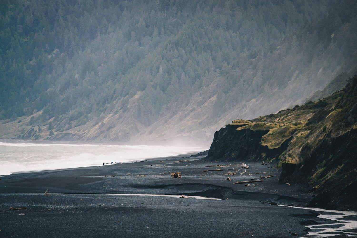
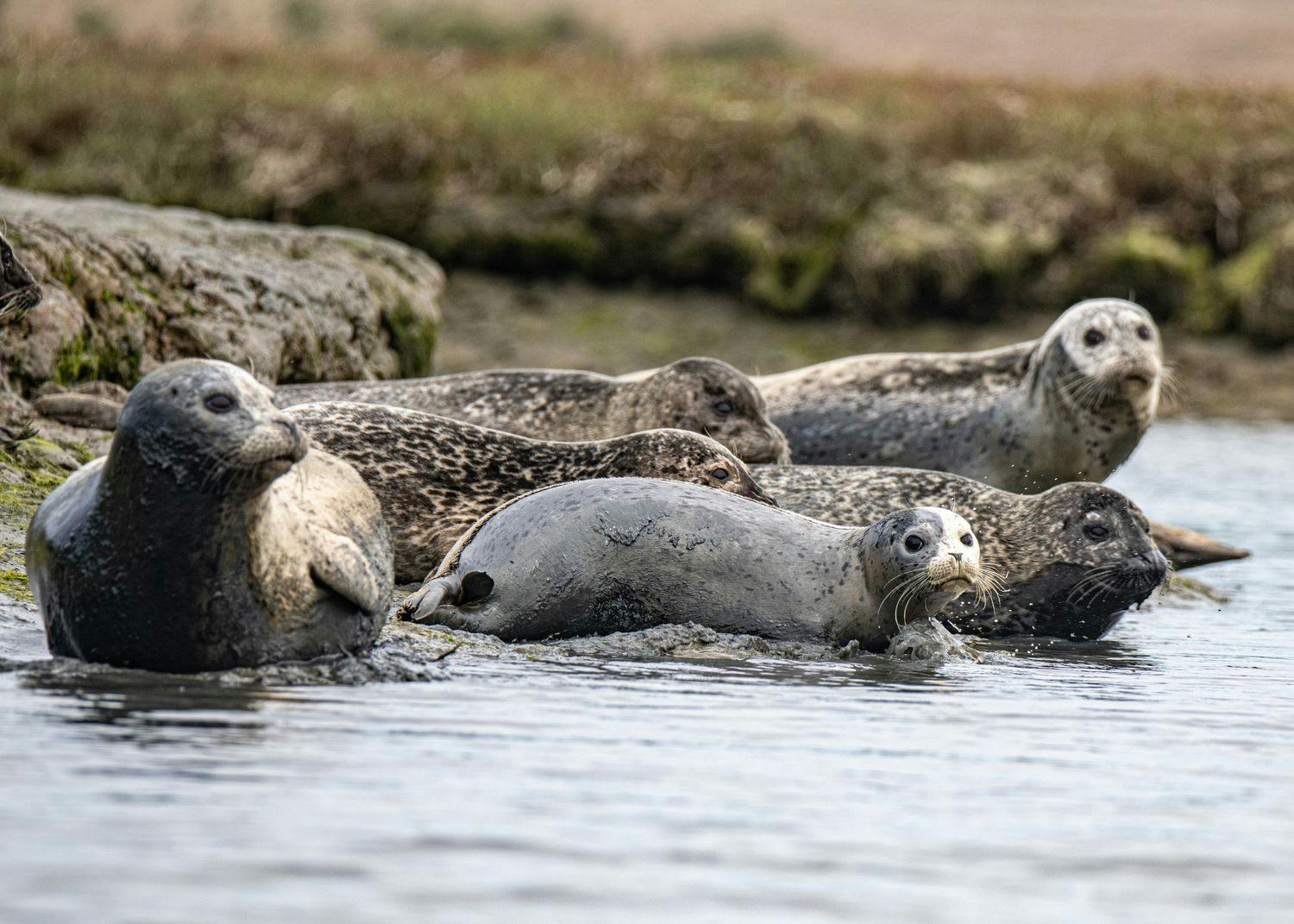
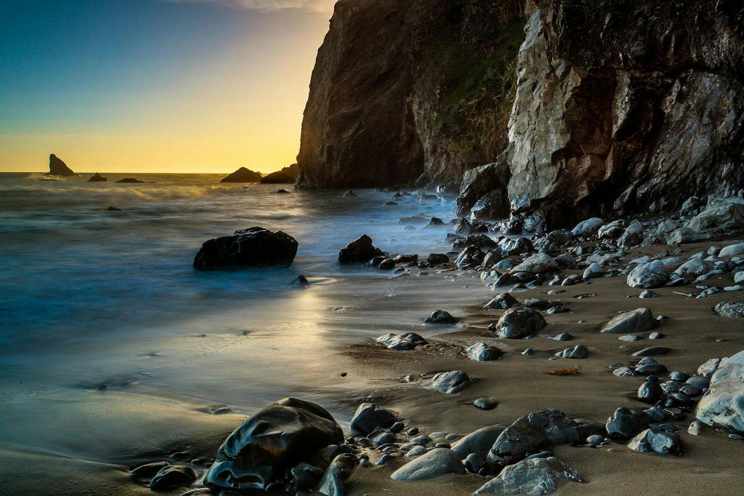
The Lost Coast is California’s most pristine stretch of coastline. You won’t find any roads, cell phone reception, or cliff-hanging mansions here. Just 80.2 mi of undeveloped shoreline marked by towering cliffs, isolated beaches, and a diverse array of extraordinary wildlife.
Thanks to its rugged, inaccessible character, construction of any major highways across its terrain has always remained too costly, leaving this remote oceanfront closed to everyone except those who are willing to explore it on foot. And the best way to do so is via the Lost Coast Trail (LCT).
Length
25.2 mi
Elevation Gain
1,030 ft
Best Time to Hike
May - Oct
Duration
3-4 days
Difficulty
Challenging
Trail Type
Point to Point
When To Go
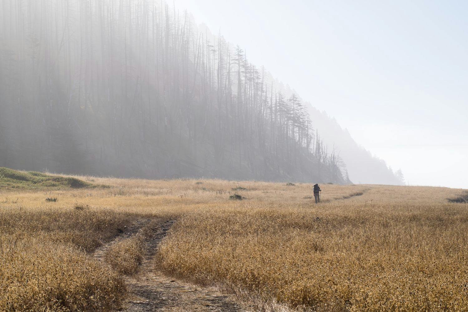
While you can technically hike the LCT year round, the best time to hike the trail is generally between May and October. In the summer months, you’ll experience warmer temperatures and less rainfall compared to the rest of the year. Regardless of when you decide to hike, be sure to pack quality rain gear and check the local weather conditions before setting out.
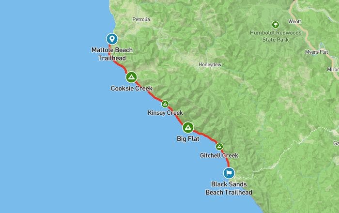
How To Get There
The LCT is located entirely within the King Range National Conservation Area in Northern California. The trail stretches 24.9 mi from Mattole Beach in the north to Black Sands Beach in the south.
Since the LCT is traditionally a point to point hike, you’ll need to arrange transportation to get you between the two trailheads. If you’re hiking in a group, one option is to bring an extra vehicle to drop off at the finishing trailhead (Black Sands Beach). Another option is to book a private shuttle. There are two official shuttle operators, Lost Coast Adventure Tours and Mendo Insider Tours, and they both offer transport from Black Sands Beach (Shelter Cove) to Mattole Beach (but not the other direction). With this option, consider parking your car at Black Sands Beach in the morning, taking the shuttle to Mattole Beach (2 hours), and starting the hike from there.
You’ll need a car to get to Black Sands Beach, as there are no public transportation options that take you all the way to the trailhead. The closest airport is the Arcata/Eureka Airport in Mckinleyville; from there, it’s a 2 hour drive to the trailhead. From San Francisco International Airport, expect a 5.5 hour drive.
Permit
A wilderness permit is required to hike the LCT. You can reserve a permit online at the Recreation.gov website. The max group size per permit is 5 people. The Bureau of Land Management (BLM) allows 60 backpackers on the trail per day from May 15 to September 15, and 30 per day the rest of the year.
As this is a very popular trail, be sure to reserve your permit well in advance. The block of permits for each calendar year are released the preceding year on October 1 (e.g. 2022 permits are available October 1, 2021). Note that there are no walk-in permits available; all permits are issued on a first come, first served basis via Recreation.gov.
Where To Camp
While you’re not required to camp in any specific area, the BLM encourages backpackers to camp at existing campsites to lessen human impact. Most of the major sites are tucked back from the beach in the narrow valleys where streams empty into the sea, offering some protection against the wind and incoming tides.
Know Before You Go
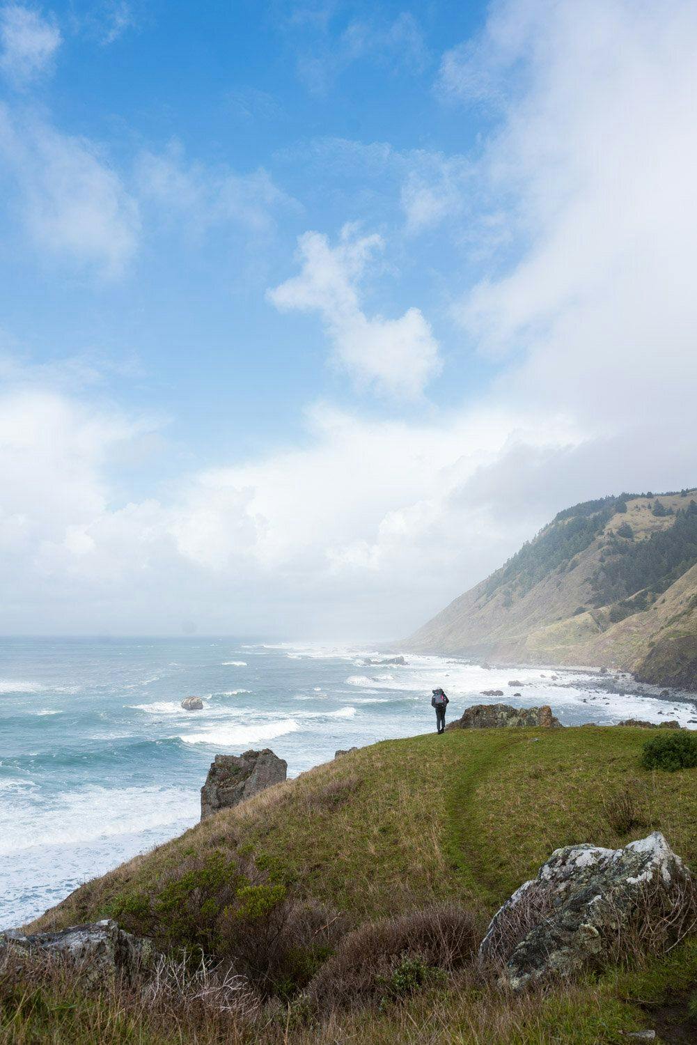
Tides - There are three stretches of the trail that are impassible at high tide: the area near Punta Gorda, the stretch from Sea Lion Gulch to Randall Creek, and from just after Big Flat to Gitchell Creek. Always carry a tide table and hike these stretches during an outgoing tide of 3 ft or less to avoid being trapped.
Weather - Be prepared for unpredictable weather and strong winds. Winds generally come from the northwest in this area of California, which is why most hikers opt to hike southward to keep the wind at their back.
Waves - Always be aware of the ocean and never turn your back to it. Large sets of waves, known as sneaker waves, can occur at any time and sweep unsuspecting hikers into the ocean.
Bears - Although your chances of encountering a black bear is pretty low, the BLM requires all hikers to store their food and scented items in an approved bear canister. Many outdoor retailers rent canisters for around $5.
Rattlesnakes - Northern Pacific rattlesnakes are found throughout Northern California, including along the Lost Coast. They will retreat if given enough space, but may strike if they feel threatened. Watch for snakes around driftwood and when walking through tall grass or brush.
Poison oak - Pacific poison oak is a common site along the LCT. They have a sticky, long-lasting oil called urushiol that causes an itchy, blistering rash after it touches your skin. Learn to recognize it so you can avoid it. If your skin does get exposed to poison oak, wash with plenty of soap and water as soon as possible.
Links & Resources
Bureau of Land Management
•
Lost Coast Trail
•
Trip Planning Guide
Recreation.gov
•
Wilderness Permit
NOAA
•
Tide Table
Shuttle
•
Lost Coast Adventure Tours
•
Mendo Insider Tours