1 / 6
Mount Rinjani
Lombok, Indonesia
Map
Directions
Save
Trail GPX file
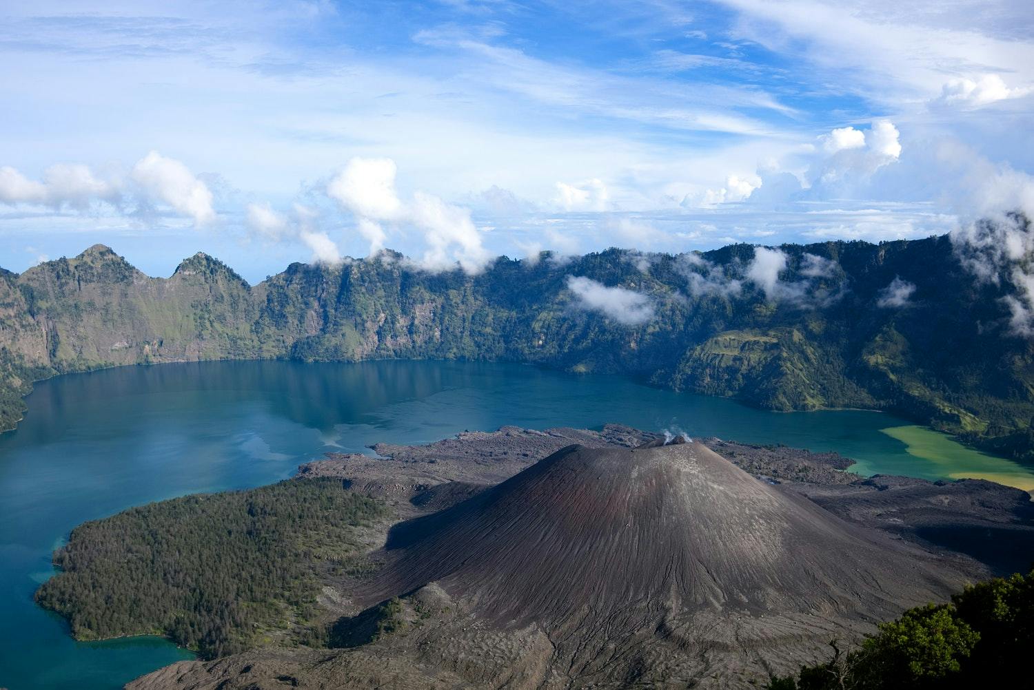
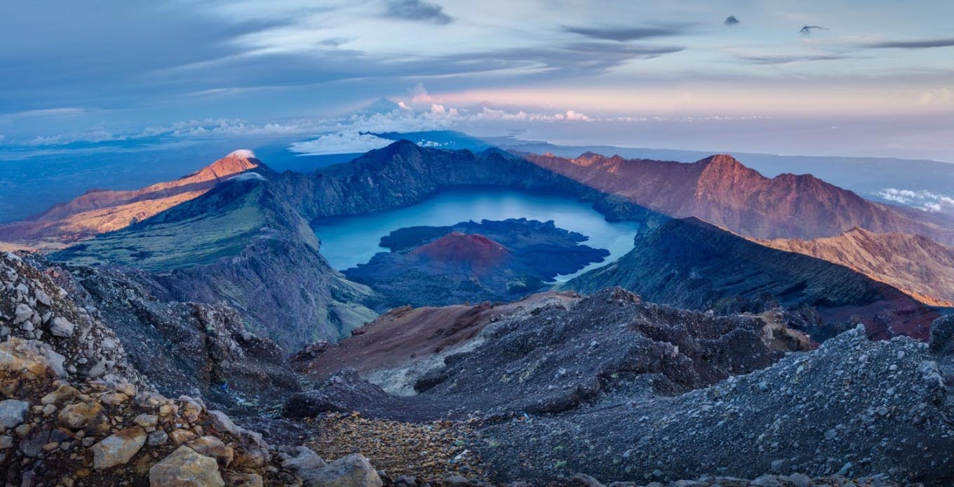
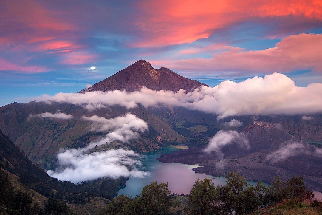
As the second highest volcano in Indonesia, Mount Rinjani dominates the landscape of the island of Lombok. While summiting the mountain is certainly possible, most hikers stop at the crater rim where the views of the crater lake are simply stunning.
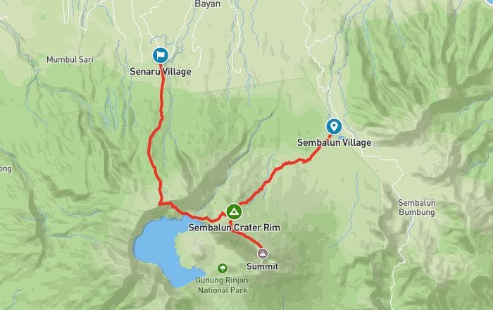
There are two main routes to summit Mount Rinjani - one starting in Senaru, the other in Sembalun. We recommend starting the trek from Sembalun because of the way the trails are configured, but either route works fine.
Length
20.8 mi
Elevation Gain
11,480 ft
Best Time to Hike
Apr - Nov
Duration
3 days
Difficulty
Challenging
Trail Type
Point to Point
When To Go
Mount Rinjani is best climbed during the April - November dry season. The hiking trails are generally closed during the rainy season from December to March. Even in the dry season, expect rainfall and near-freezing temperatures at the summit.
All hiking trails on Mount Rinjani were closed for about a year following earthquakes on Lombok in 2018. As of July 2019, it’s possible to hike to the Crater Rim, but not to the summit. All trails are scheduled to be fully operational by April 2020, including the route to the summit. Be sure to check trail conditions before you start planning your hike on the official trail website.
How To Get There
Mount Rinjani is located on the Indonesian island of Lombok, just east of Bali.
There are two starting points for climbing Mount Rinjani - Senaru and Sembalun. Here are the pros and cons of each trailhead:
•
If you want to summit in two days (one night on the trail), you have to go via Sembalun in order to reach the summit first thing on day two.
•
If you’re not planning on summiting and you only have two days, Senaru is a good choice. While the trail through the rainforest is steeper, it’s also a more beautiful and shaded route than via Sembalun. However, you won’t be able to summit in two days if you choose this route.
•
If you’re doing a longer hike (three days, two nights or more is recommended), either trailhead will allow you to summit. The difference is just a matter of when - if you want to summit earlier, choose Sembalun. If you want to summit later, choose Senaru.
Whether you start in Senaru or Sembalun, fly into Lombok International Airport and take a taxi to the trailhead (2.5-3 hrs). It’s also possible to take a ferry to Lombok from Bali, but this will add an extra day to your itinerary.
Permit
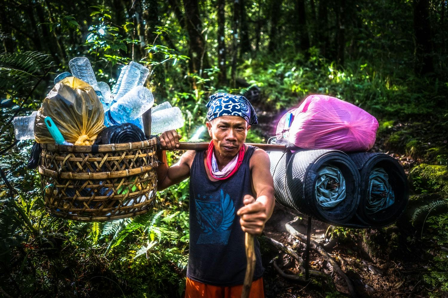
While no permit is required for summiting Mount Rinjani, you will have to buy an entry ticket to Mount Rinjani National Park (Rp 150,000 per person). If you decide to hire a guide and porters (which is highly recommended), the park entrance fee is included in the total cost.
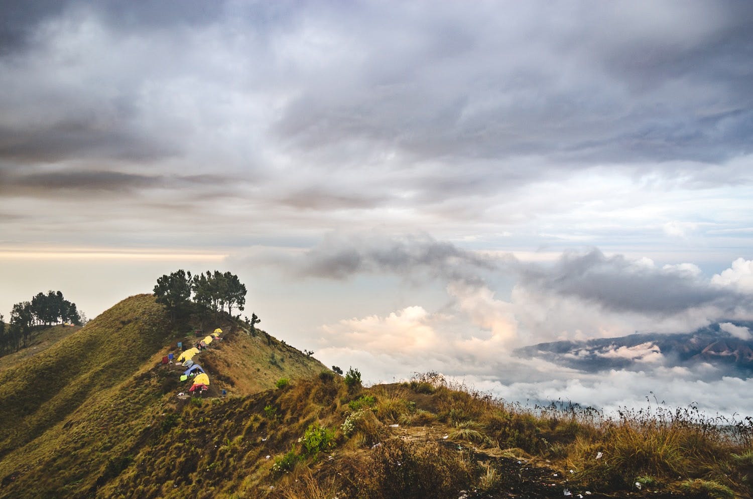
Where To Camp
There are three campsites along the trail: Sembalun Crater Rim, Segara Anak Lake, and Senaru Crater Rim. If you opt for a 3 days / 2 nights hike, you’ll be camping at Sembalun Crater Rim and Senaru Crater Rim. If you have four days on the trail, you’ll spend the second night at Segara Anak Lake.
Know Before You Go
As of July 2019, it’s possible to hike to the Crater Rim, but the route to the summit is still undergoing maintenance. All trail routes should be fully open by April 2020, but be sure to check trail conditions before you start planning your hike on the official trail website.
If you’re attempting to summit Mount Rinjani, be physically and mentally prepared for the climb. It’s a grueling 3,560 ft push to reach the summit on the second day. The sunrise views coming down make it all worthwhile.
Links & Resources
Mount Rinjani National Park
•
Mount Rinjani Trek