1 / 7
Teton Crest Trail
Grand Teton National Park, USA
Map
Directions
Save
Trail GPX file
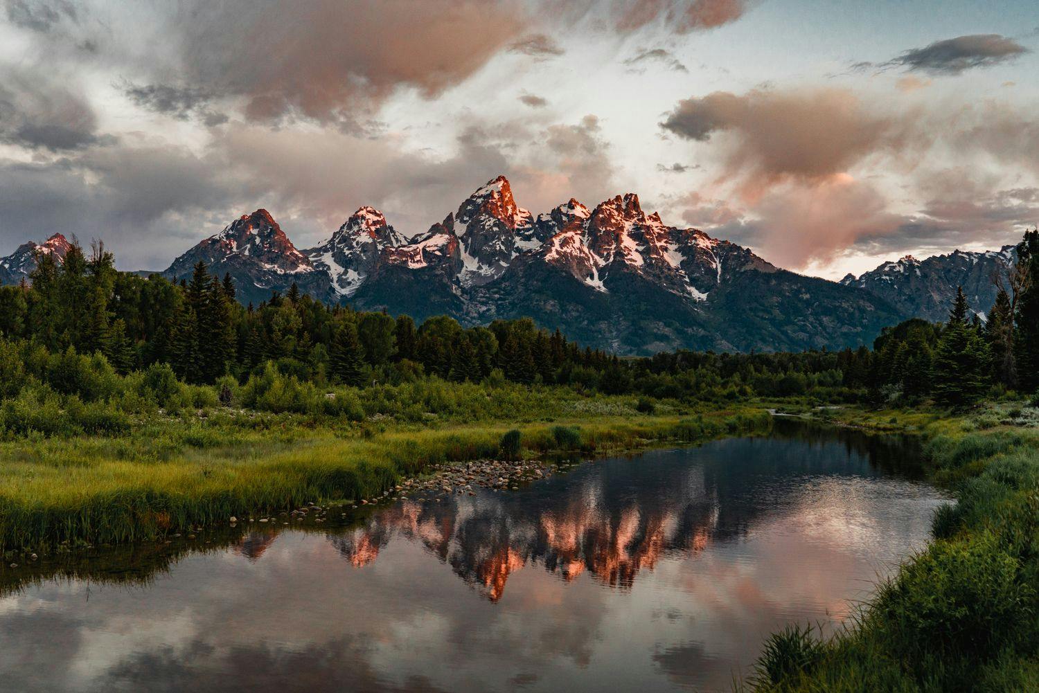
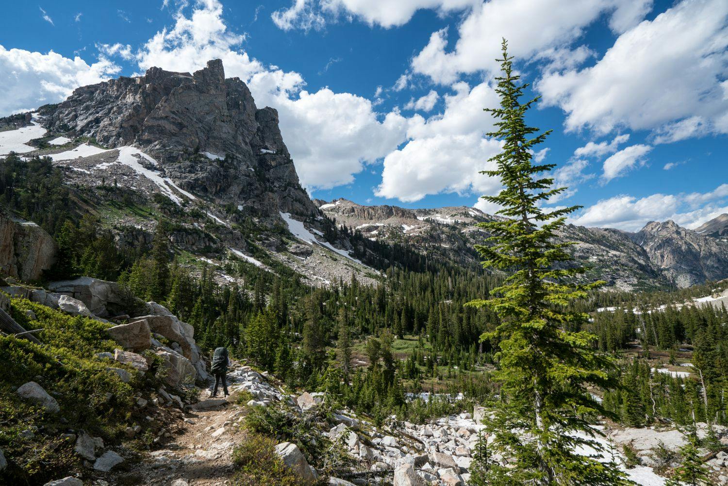
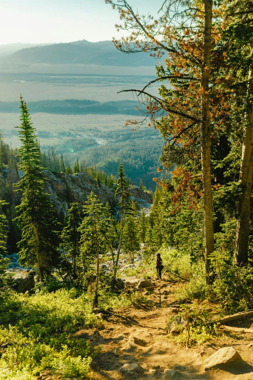
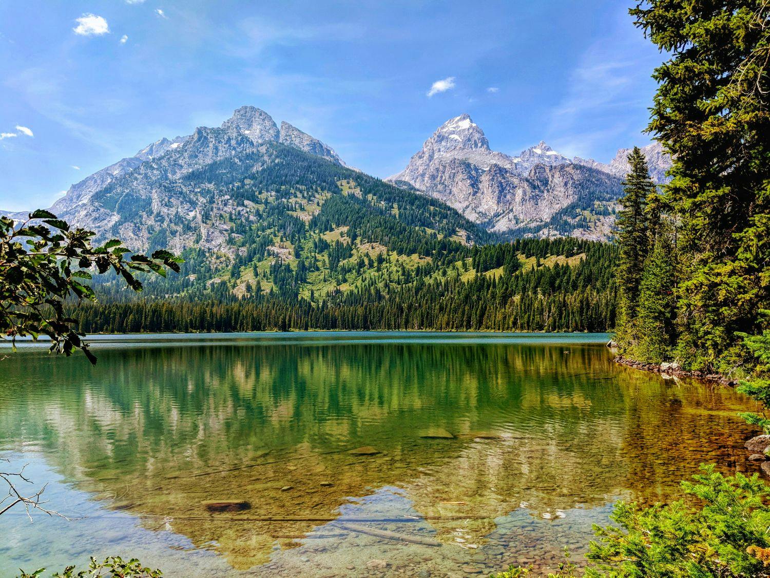
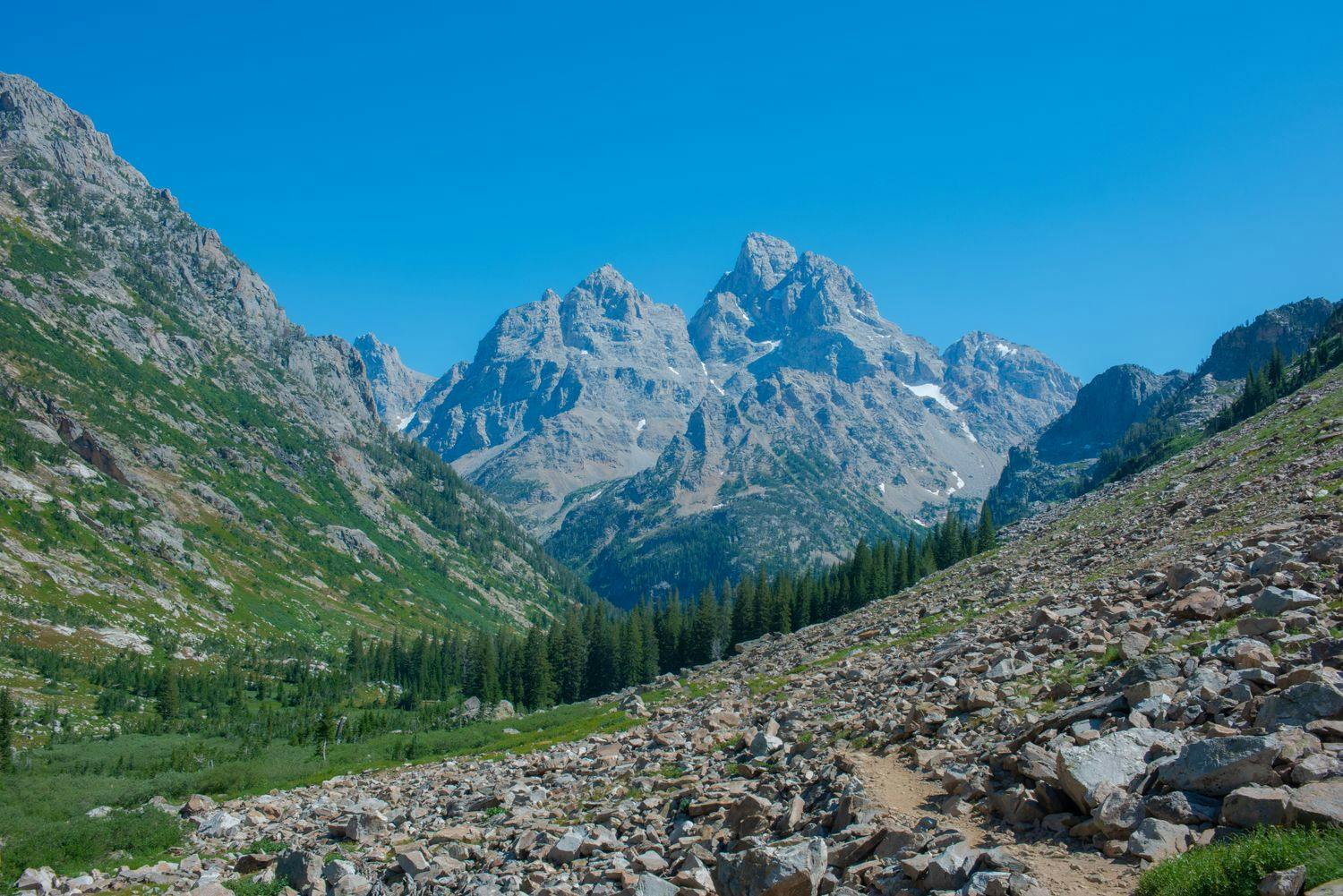
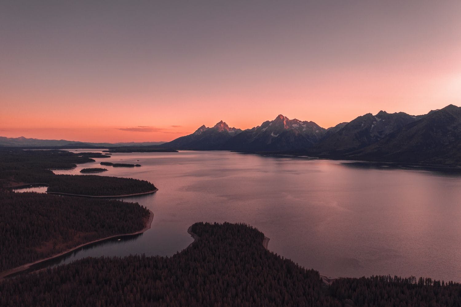
As one of the most scenic hikes in North America, the Teton Crest Trail (TCT) offers spectacular views of towering granite peaks, glacier-carved canyons, glistening alpine lakes, and wildflower meadows. This 39.4 mi trail cuts through Grand Teton National Park, the Jedidiah Smith Wilderness Area, and two national forests, rarely dropping below 7,900 ft.
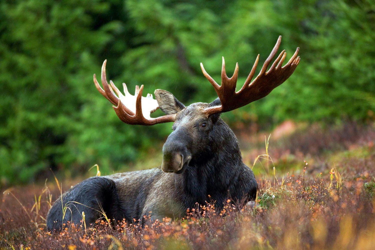
In terms of wildlife, the Grand Teton Mountains are home to moose, bison, black and grizzly bears, mountain lions, bighorn sheep, and many other species. As Yellowstone National Park is less than an hour’s drive away, consider combining your time in the Tetons with a few days of exploring Yellowstone’s geologic wonders.
Length
39.4 mi
Elevation Gain
9,048 ft
Best Time to Hike
Jul - Sep
Duration
4-6 days
Difficulty
Challenging
Trail Type
Point to Point
When To Go
July to September are generally the best months to hike the TCT. Snowpack is a key factor you should consider when planning your trip, as snow can linger on passes late in the year. At elevations below 6,600 ft, the snow has generally melted by mid June. For higher elevations along the trail, the snow melts progressively into mid July. Snow and rain can fall at any time of the year here, so be prepared for cold and wet conditions.
You may need an ice axe and microspikes to safely cross the Fox Creek, Hurricane, and Paintbrush Divide passes depending on snowfall and the time of year. Always check with the Grand Teton National Park Service for weather conditions before starting your hike.
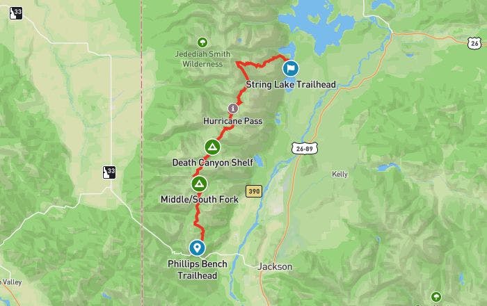
How To Get There
The TCT is located in Grand Teton National Park, around 4.7 mi from Jackson, Wyoming. We recommend renting a car once you arrive at Jackson Hole Airport. That way you can easily drive to pick up your permit at one of the permit offices and make your way to the trailhead.
As this is a point to point hike, you’ll need to organize some type of transport to get you between the two trailheads. Plan on leaving your car where you’ll end the hike at the String Lake Trailhead and have another car (local taxi, Uber, or private shuttle) take you to the Phillips Bench Trailhead where you’ll start the hike. Hitchhiking to the trailhead is also an option, depending on your comfort level.
Permit
A backcountry permit is required for hiking the TCT. On-third of the campsites can be reserved in advance online, with the remaining sites being filled on a first-come, first-served basis at the park permit offices. As the TCT is very popular, online reservations are recommended.
To reserve a permit online, submit your request from early January to May 15th on the Recreation.gov website. After you’ve reserved your permit, you’ll still need to pick it up before 10 am on the morning your hike begins. Permits can be picked up at the Craig Thomas Discovery and Visitor Center, Colter Bay Visitor Center, or the Jenny Lake Ranger Station.
If you’d rather take a chance on a walk-in permit, keep in mind that you have to secure your permit at least 24 hours before you intend to start your hike. Your odds of getting a walk-in permit are quite fair if you can get in line bright and early at one of the permit offices mentioned above.
Where To Camp
The campsites along the TCT are plentiful, but most of the sites do require you to get a backcountry permit in order to camp there. There are a couple of sites located outside the park boundaries where you can camp without a permit, including Alaska Basin and Fox Creek Pass.
Individual campsites can accommodate one to six people and run on a first come, first served basis. If you’re hiking in a group of more than six people, you have to use the group sites specifically assigned to you by the park rangers.
Know Before You Go
Snow - Snow conditions vary each year. You may need to bring an ice axe and microspikes to safely cross some of the higher elevation passes until around the third week of July. Be sure to check with the Grand Teton National Park Service for the snow conditions of the passes before starting your hike.
Bears - The TCT passes through bear country. We recommend hiking with bear spray (and knowing how to use it). Remain bear aware for the entirety of your hike and keep all of your food and scented items in an approved bear canister when not in use. Bear canisters can be checkout out for free when you pick up your permit.
Thunderstorms - Afternoon thunderstorms are common on the TCT. If you see a storm approaching, find shelter and avoid exposed summits, open areas, and lone trees.
Repellent - Mosquitoes can definitely be an issue, especially at lower elevations and close to lakes. Be sure to pack bug repellant and long sleeved clothing. Hiking the trail in September generally offers the least contact with bugs.
Alternative trailheads - While the TCT officially starts at Phillips Bench Trailhead, there are several alternative trailheads available. A popular route is taking the Teton Village Aerial Tram to the top of Rendezvous Mountain and starting the hike from there. Another option is starting from the Granite Canyon Trailhead, which makes for a less strenuous and shorter first day of hiking.
Links & Resources
National Park Service
•
Grand Teton National Park
•
Backcountry Camping
•
Backcountry Trip Planner
Recreation.gov
•
Backcountry Permit