1 / 6
The Narrows
Zion National Park, USA
Map
Directions
Save
Trail GPX file
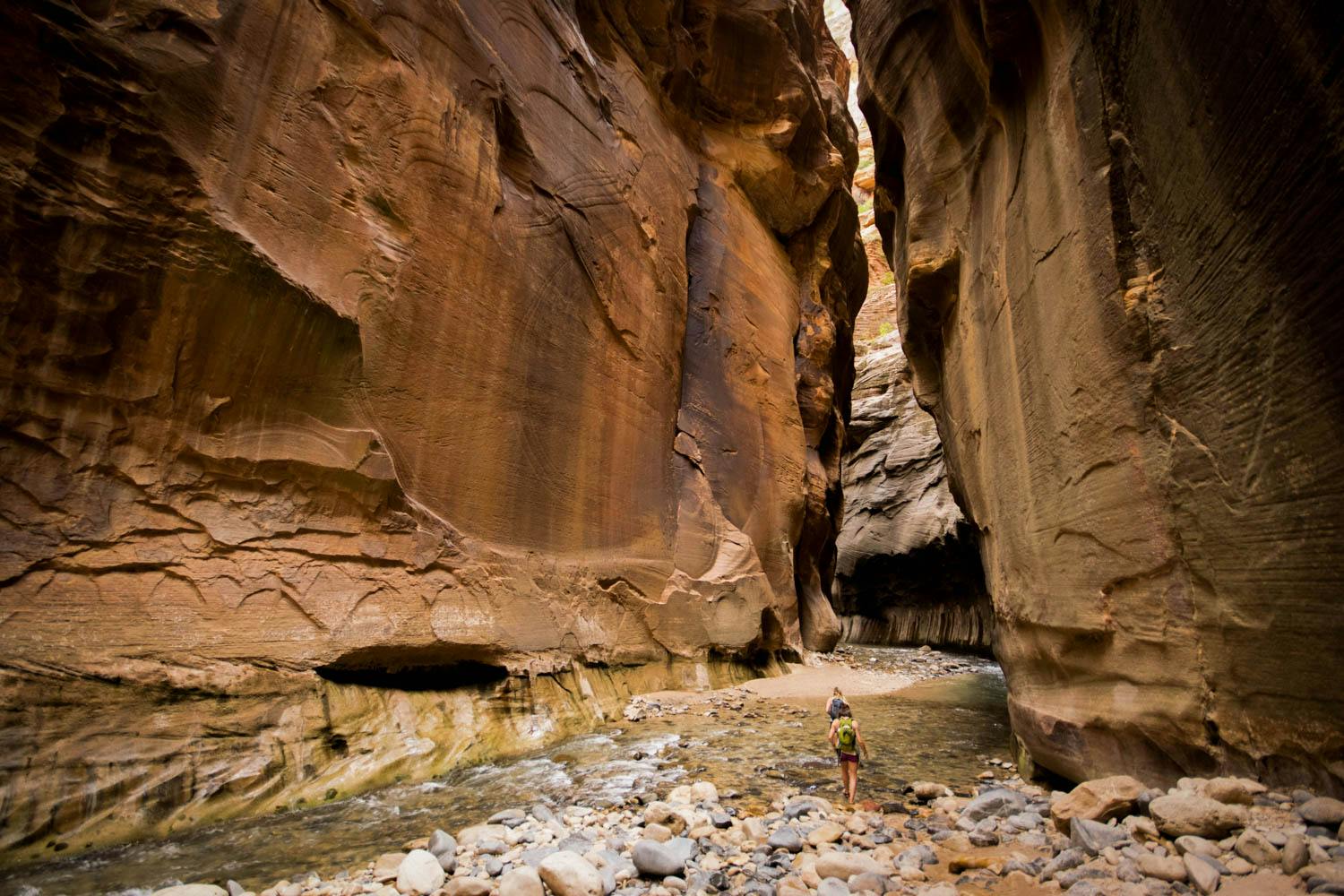
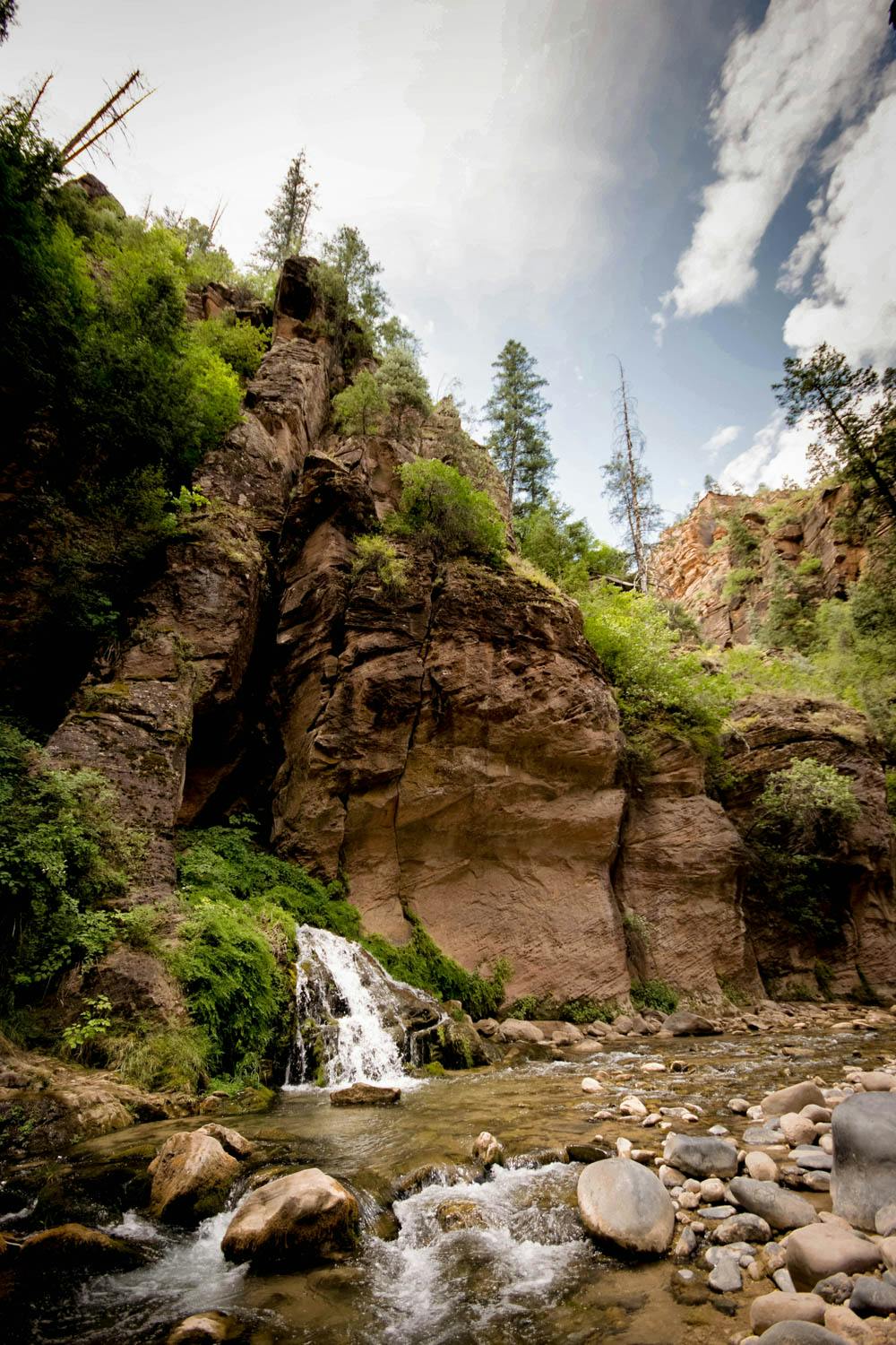
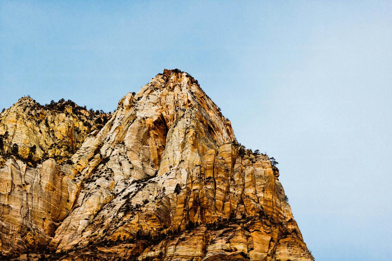
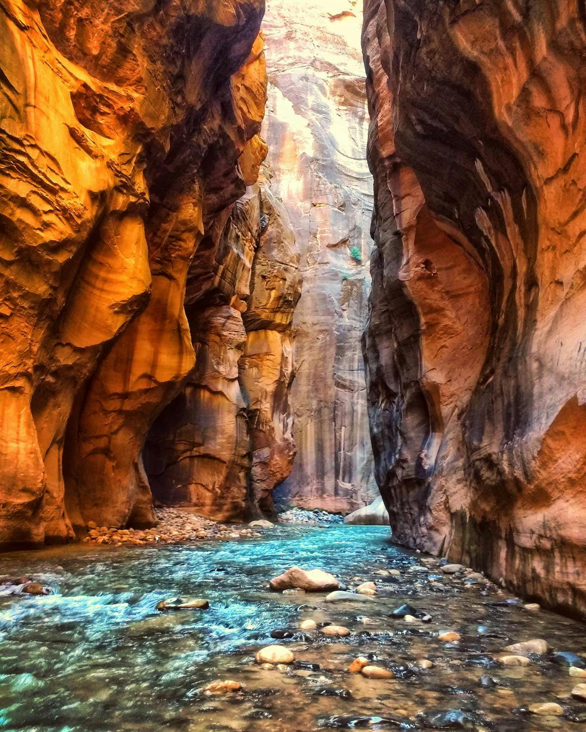
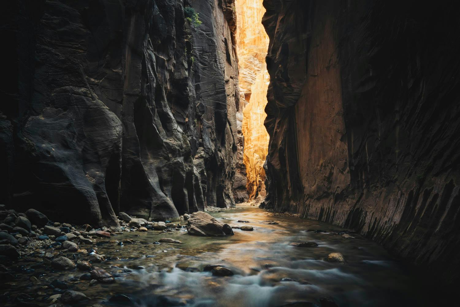
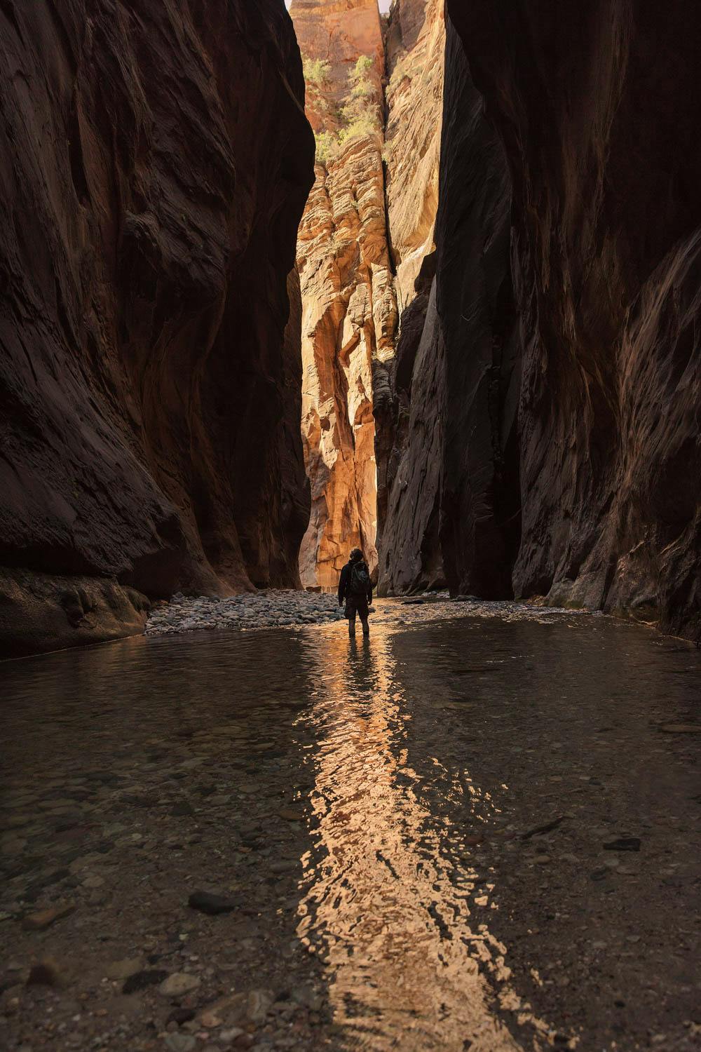
Zion has some of the most beautiful red rock scenery in the American West. And among Zion’s iconic scenery, The Narrows Top Down Trail via Chamberlain’s Ranch captures an incredible sense of natural elegance in the desert. To walk through the rushing waters and shoreline paths feels as unique as it is beautiful.
The trail packs a punch in terms of adventure. Each twist and turn reveals canyon walls and water that could be up to your ankles or up to your shoulders. Provided you are adequately prepared and understand the risks of flash floods, The Narrows is an endlessly fun and exhilarating trail through top class scenery.
Length
16 mi
Elevation Gain
2,500 ft
Best Time to Hike
Sep - Oct
Duration
2 days
Difficulty
Challenging
Trail Type
Point to Point
When To Go
The Narrows is a difficult trail to pin down a time to go. There are years when the trail opens in March and other years it opens as late as July. This variability is a product of the trail’s water flow measured in cubic feet per second (CFS). The CFS depends on how much rain and snow has fallen during the previous seasons. If the CFS is too high (120 CFS or above causing water to be chest deep or deeper), the trail stays closed and may not open until late spring to summer. However, even if it’s summer or fall and the weather suddenly changes, the National Park Service may close the trail within a moments notice.
The unpredictable conditions that can stop backpackers and hikers can be mitigated by planning a trip later into summer, specifically around September to October. With the fall months comes cooler weather and water which will require extra careful preparations in terms of gear and clothing to withstand the colder nights and water. There are definitely trade offs and some luck involved when choosing dates but roughly September to October may still be the best option.
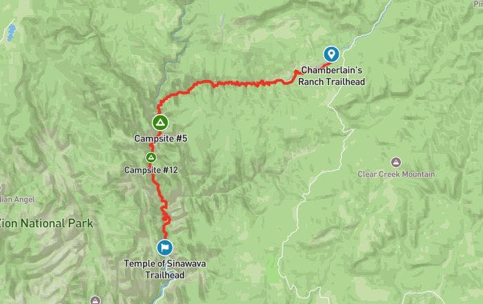
How To Get There
To get to the Chamberlain’s Ranch Trailhead (also known as Zion Narrows Upper Trailhead), you’ll need to exit Zion National Park from the East Entrance on Highway Route 9. The closest airports to Zion National Park are in Las Vegas (3 hrs by car) and Salt Lake City (5 hrs by car). After about 1.9 mi you will see a paved turnoff going north called North Fork Road. Eventually the road turns from a paved road to a dirt road, but should be drivable for regular cars in dry conditions. After 16.8 mi you will get to a gate blocking the road. Open and close the gate behind you as the area is used for cattle. A short distance further you with find the parking area where the trail begins.
Alternatively, there are shuttle services that will take you to the trailhead so that you don’t spend extra time parking two vehicles at either end of the trail. Space is limited on these shuttle services, so book well in advance of your trip. Shuttle cost ranges between $25-40 per person. There are several companies that offer this service, including Red Rock Shuttle, Zion Adventures and Zion Guru.
Permit
You must have a permit to camp at all campsites and for hiking specific stretches of The Narrows trail. Specifically the route between Big Springs and the trailhead at Chamberlain’s Ranch are off limits to any hiker or camper without a permit (for someone just hiking, the permit is different and does not allow them to camp anywhere on the trail).
Getting a permit for a campsite includes access to the entire trail. However, getting any permit can be a very difficult and confusing process if you don’t acquire one when they become available through the official website. To have any chance of getting a permit before your trip, you must reserve on the official Narrows website on the 5th day of the month looking 2-3 months ahead. For example, if you want a date in September, you will need to book your date on the 5th of July. Because of the trail’s popularity, the available online permits will go quickly so act fast to get your spot (at 5 pm MT sharp).
If you don’t get your permit online but are still determined to go, there’s a small possibility of finding an availability 1 week to 1 day prior to your trip via a “last minute drawing” or as a “walk-in”. These options bring the risk that you won’t get to camp or go past Big Springs on the Narrows trail. Make sure you have a backup plan so you can enjoy the astonishing beauty of the area if there are no more permits.
Where To Camp
There are 12 designated campsites in The Narrows. The campsites are sprawled throughout a relatively long section of the trail between the Deep Creek confluence and Big Springs. Depending on which campsites are still available, you could either have more hiking to do on the second day or roughly an even amount of hiking between each day.
Since each campsite is beautiful in its own right, a better way of deciding would be to try to match the campsite capacity to the amount of people in your group. For brief descriptions of each campsite, information on whether they can be booked in advance or not, and pictures of each site, visit the official website.
Know Before You Go
Clothing - even if you’re just going on a quick day hike, bring extra clothes and make sure to have layers that are non-cotton such as neoprene socks, synthetic coats, and quick drying thick sole shoes to withstand the cold water. Temperatures can change very quickly in The Narrows, especially if you’re going to be camping overnight. Make sure your extra clothes are in a waterproof bag within your pack.
Waste bags - you are required to dispose of solid human waste in designated bags. If you don’t have them, you can buy the bags at the visitors center. When you need to urinate, do so in fast running water. Never urinate on fragile plants or soil.
Where to walk - you should always try to walk in the water where possible. When too many people walk on the banks of the river it causes soil erosion. To help you walk in the water, have a reliable walking stick. Many sections of the water have rocks that make it easy to lose your footing.
Weather/flood risks - flash floods are uncommon when the trail is open for use but can happen. The floods can reach their full water potential within 5 minutes, so it’s very important to realize when it’s happening as flash floods can cause deaths. If any of the following signs occur, make for the highest ground you can since flood waters could reach up to 12 ft above the current water level:
•
Water levels rise suddenly and unexpectedly or you hear loud noises/rushing water
•
The color of the water has noticeably changed
•
There are large amounts of debris coming down the river
•
The weather where you are or nearby becomes rainy or storm clouds gather
Links & Resources
National Park Service
•
Zion National Park
•
The Narrows Permit
•
The Narrows Campsites
Shuttle to trailhead
•
Red Rock Shuttle
•
Zion Adventures
•
Zion Guru