1 / 7
Wonderland Trail
Mount Rainier National Park, USA
Map
Directions
Save
Trail GPX file
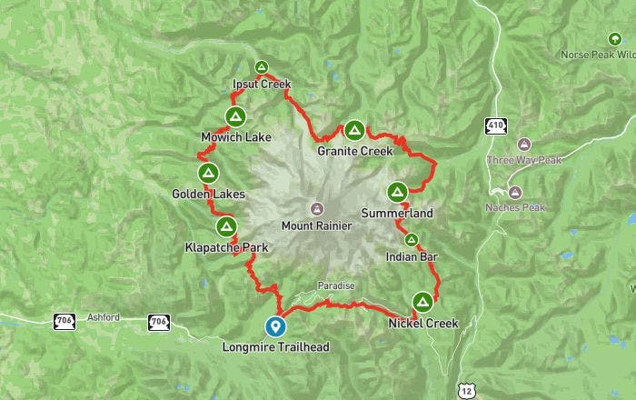
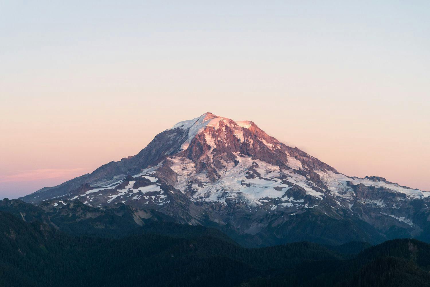
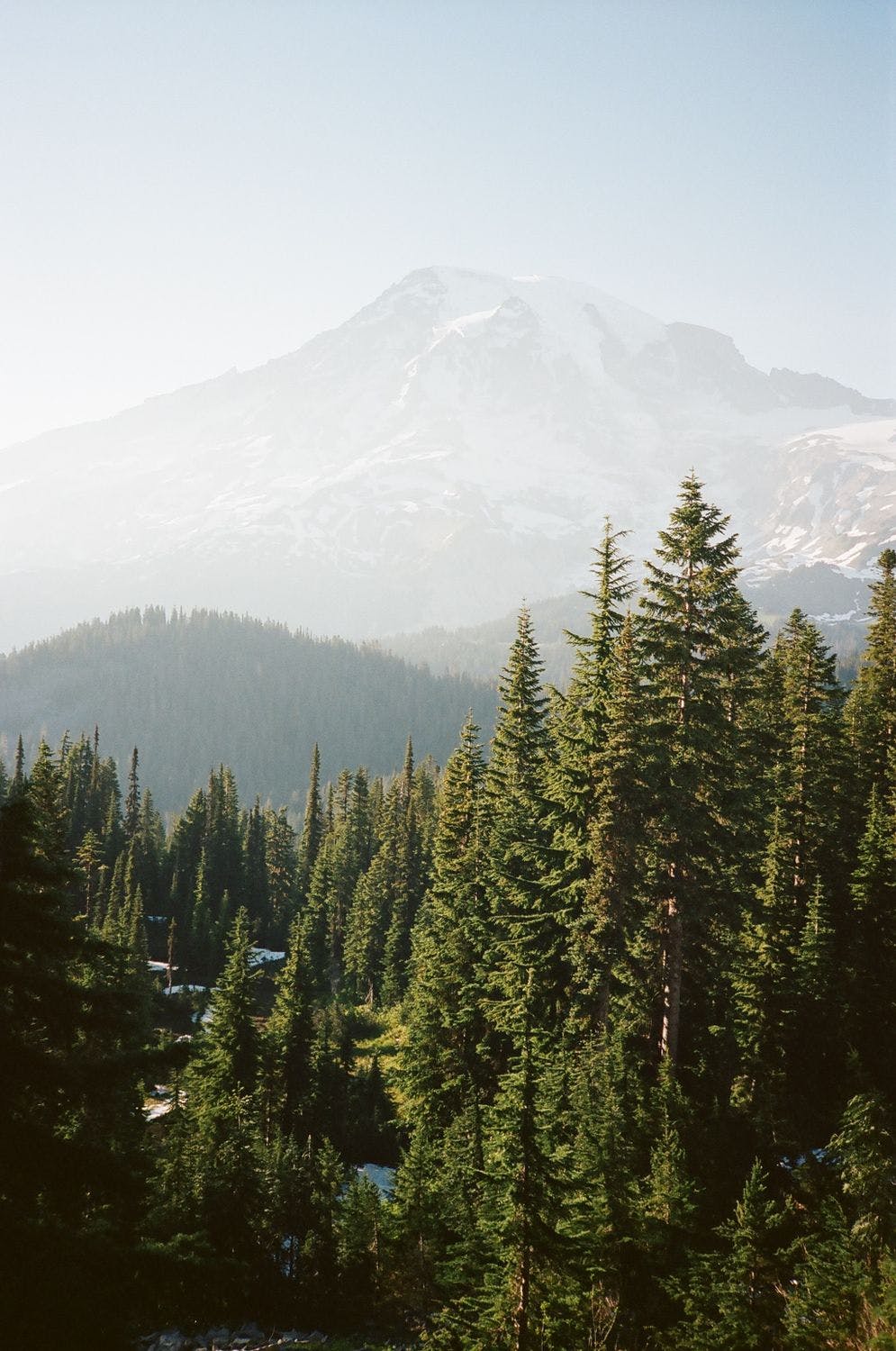
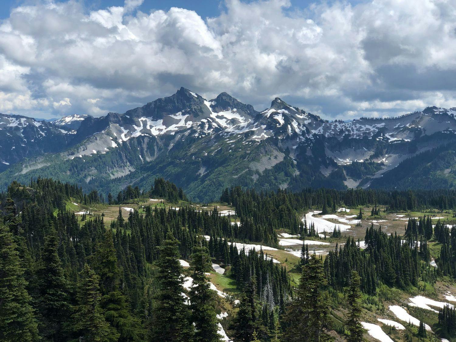
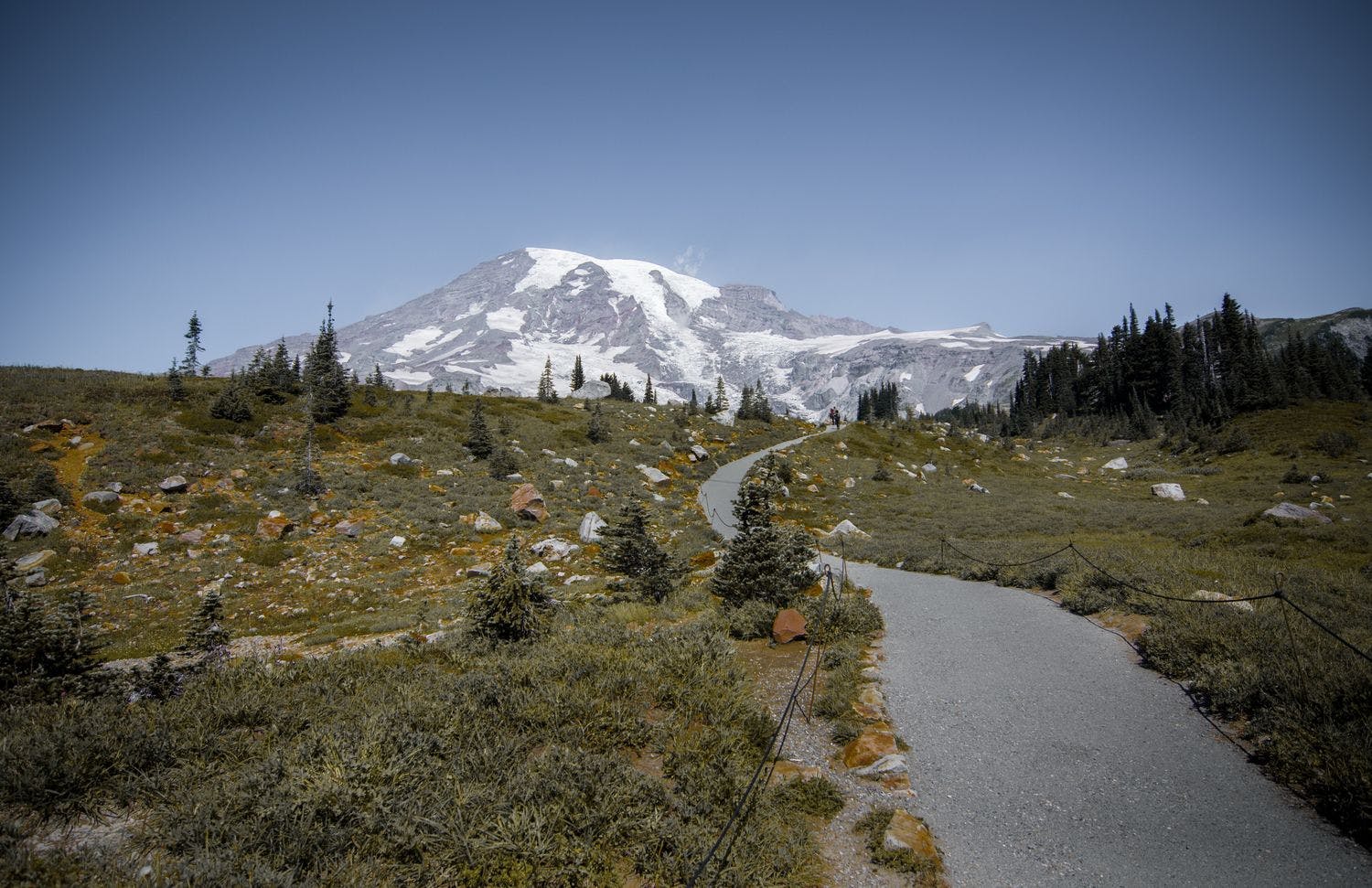
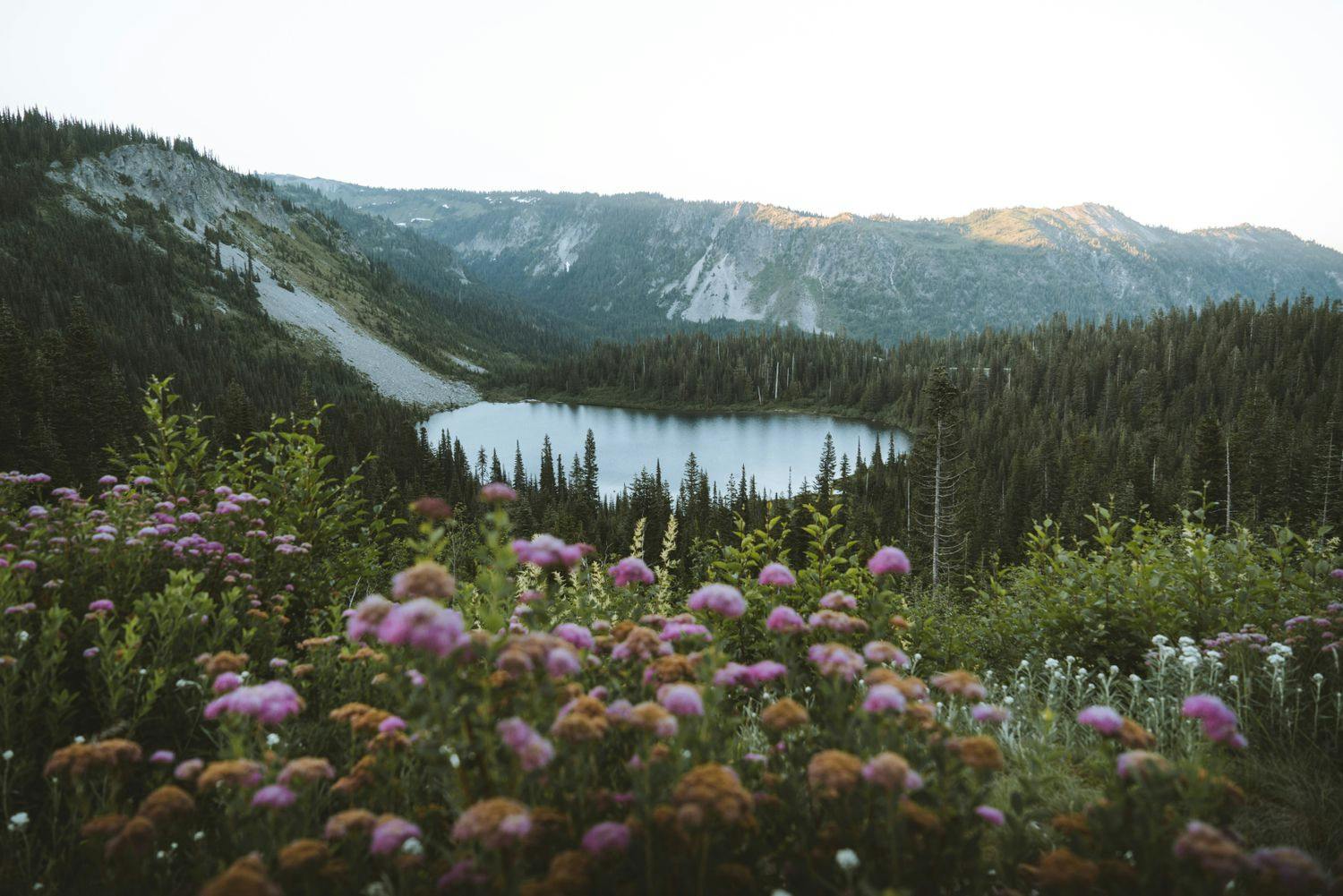
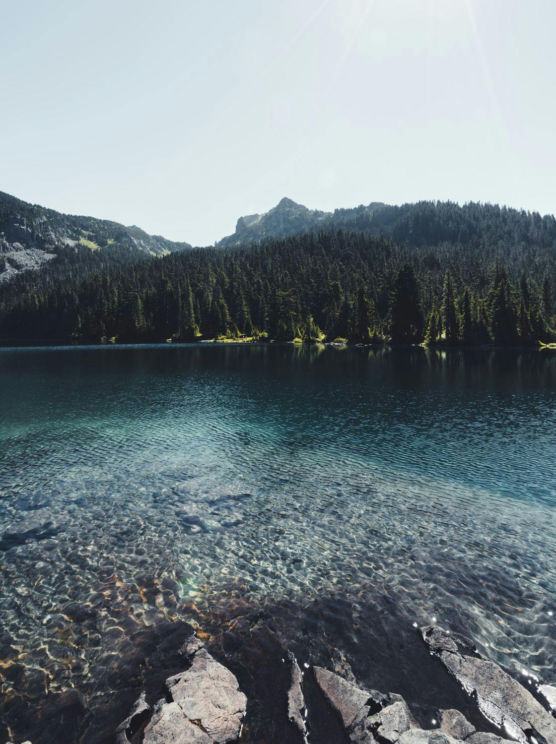
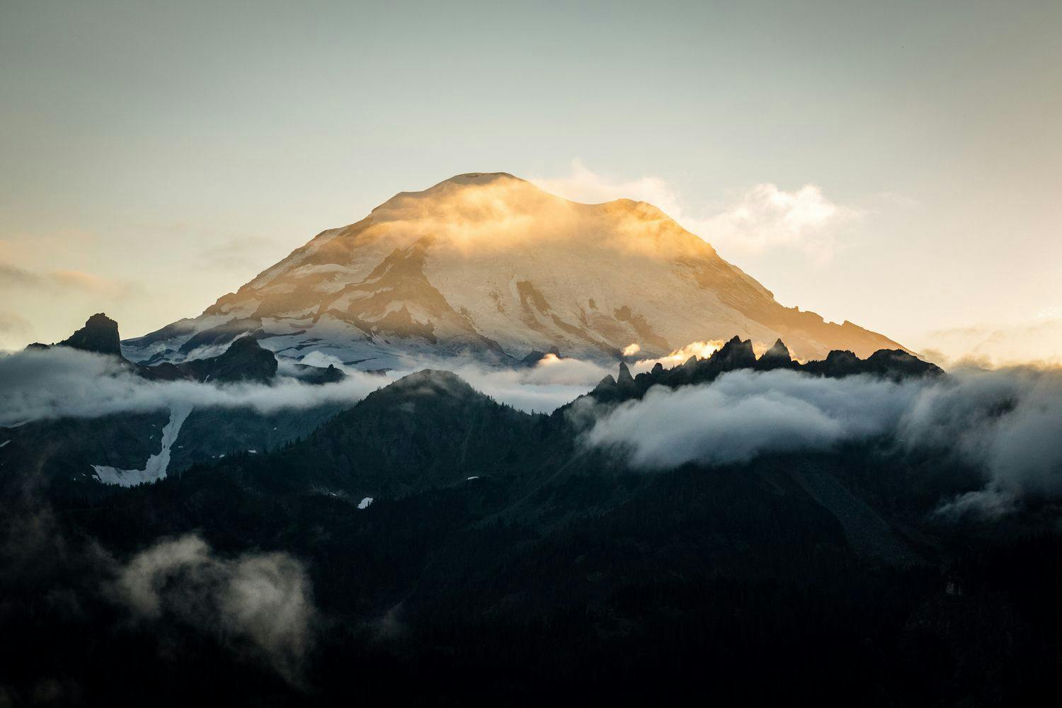
Located in Mt. Rainier National Park, the Wonderland Trail loops its way around the majestic Mt. Rainier over the course of 85.4 mi. The presence of Mt. Rainier alone would make for an impressive hike. In actuality, the trail intermittently leaves the views of Mt. Rainier behind to offer views of temperate rain forests, alpine meadows, and lush volcanic valleys.
The trail can be completed by backpackers with reasonable experience in 6-10 days. Your main challenges along the way will be dealing with the constant elevation gain and loss throughout the trip and the potential for heavy rainfall. With the right attitude though, these challenges will not distract you from the sheer beauty of the area.
Length
85.4 mi
Elevation Gain
24,468 ft
Best Time to Hike
Jul - Oct
Duration
6-10 days
Difficulty
Challenging
Trail Type
Loop
When To Go
Most years, the times available to hike the Wonderland Trail are between July and October when the snow has melted enough to reveal the trail to hikers. While August might initially seem like the best month to hike the trail as the weather is a bit warmer and there are still flowers in bloom, the demand for permits is also higher and the mosquitoes are out in full force. With that in mind, we recommend that you get a permit at any point in September. While you might experience cooler temperatures and more rainfall, the chances of getting a permit are higher and you’ll run into fewer mosquitoes.
How To Get There
The Wonderland Trail is located in Mt. Rainier National Park, 84.5 mi southeast of Seattle. Most visitors will arrive from the Seattle area or Seattle’s main airport Seattle-Tacoma International Airport (SEA). From here your best option is to rent a car. Currently, there are no shuttle or bus services that take people directly to Mt. Rainier National Park. The closest you could get with public transportation is taking a train to Puyallup Station. But even then, you will still have to take an Uber or taxi the rest of the way. It’s still a long distance and would be expensive considering you would need to a taxi back as well. Renting or driving your own car will allow you to have more control over the timing of your trip with significantly less hassle.
While there are several official trailheads, the most popular one is at the Longmire Wilderness Information Center. To get there. drive east on Hwy 706 from Ashford for 9.9 mi. The center is located in the Longmire Historic District, 6.5 mi past the Nisqually Entrance to Mt. Rainier National Park.
Permit
Permits for overnight camping in Mt. Rainier National Park are required year-round. As the Wonderland Trail is extremely popular, we recommend that you reserve your permit well in advance. Approximately two thirds of permits can be reserved online; the remaining one third are issued at park Wilderness Information Centers on a first-come, first-served basis.
There is an early access lottery that gives you a better chance to secure a permit for the most desirable dates (typically August through September). The application period for the early access lottery is February 21 - March 7. You can apply for the lottery on the Recreation.gov website. All remaining online permits become available on April 25.
You also have the option to get a walk-up permit at one of the Wilderness Information Centers (like the one at Longmire). Walk-up permits can only be obtained in person up to one day before your trip starts.
Whether you’re reserving your permit online or going with the walk-up option, you chances of success increase by avoiding public holidays, beginning your hike mid-week, and being as flexible as possible with your itinerary.
It is actually possible to hike the Wonderland Trail without a permit if you only camp at the three non-wilderness campsites (Mowich Lake, White River, and Cougar Rock), which are all accessible by car and don’t require a permit. However, if you go with this option you’d have to complete the entire hike in just three days and average around 31.1 mi a day. If you’re experienced and in very good shape, it’s feasible, but don’t underestimate the difficulty of the trail as this could lead to injury and exhaustion.
Where To Camp
There are 18 wilderness campsites and 3 non-wilderness campsites along the Wonderland Trail. Camping outside of these designated campsites is not permitted. Each campsite is equipped with a pit toilet, anti-bear food storage, and a nearby water source. Every campsite has 2 to 8 camping spots that each fit 2 tents. All but 3 of the campsites also have a group site, which you’ll need to use if you have a party of 6-12 people. See the official Wonderland Trail website for a complete list of all the campsites.
Know Before You Go
Food resupply - Planning one or two food drops to reduce pack weight is very common on the Wonderland Trail. There are four locations where you can cache food along the trail:
•
Longmire Wilderness Information Center
•
Mowich Lake Patrol Cabin
•
Sunrise Visitor Center / White River Campground (located very close to each other)
You can ship food drops to these locations in advance or drop them off in person before you start your hike. If you do decide to drop off food in person, be sure to give yourself a full day for driving to the cache locations. See the NPS website for full instructions.
Trail direction - Since the trail is a loop, you can hike it either clockwise or counterclockwise. Most people hike it clockwise, but from a difficulty perspective, it doesn’t really matter which way you go.
Elevation change - While not a technically demanding hike, there are many climbs and descents on the Wonderland. In fact, it’s very rare that you’ll find yourself walking on flat terrain along the trail. Don’t forget to take this into account when planning how far you want to hike each day.
Bears - There are black bears in Mt. Rainier National Park and it’s not uncommon to see them. All campsites along the trail are equipped with a bear pole, which makes storing your food at night a lot easier. If you do end up seeing a bear at camp or on the trail, do not make sudden movements and make calm, assertive noises so that it can clearly hear you and know where you are.
Weather & clothing - If you look up the weather in Seattle and expect the weather to be the same on Mt. Rainier, you could be in for a surprise. The weather around Mt. Rainier on the Wonderland Trail can be a lot wetter than surrounding areas. Even in the middle of summer there’s a reasonable chance it could rain more often than not. Bring waterproof bags and clothes and make sure you have spare layers in case you get soaked.
Spray Park alternate route - There is a detour between Carbon River and Mowich Lake that deviates from the traditional Wonderland Trail route. The Spray Park route is higher, tougher, and more scenic than the regular route. If you do decide to go this way, you’ll be rewarded with a stunning view of the area and the spectacular 354 ft waterfall Spray Falls.
Links & Resources
National Park Service
•
The Wonderland Trail
•
Wilderness Trip Planner
•
Wilderness Permits
•
Elevation Profile
•
Caching Food and Fuel
Recreation.gov
•
Permit Reservations